Pearl Harbor Hydrographic Survey, Joint Base Pearl Harbor Hickam
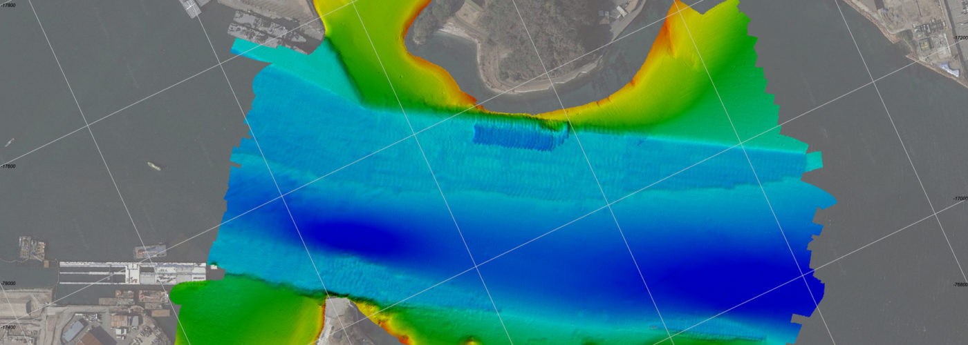
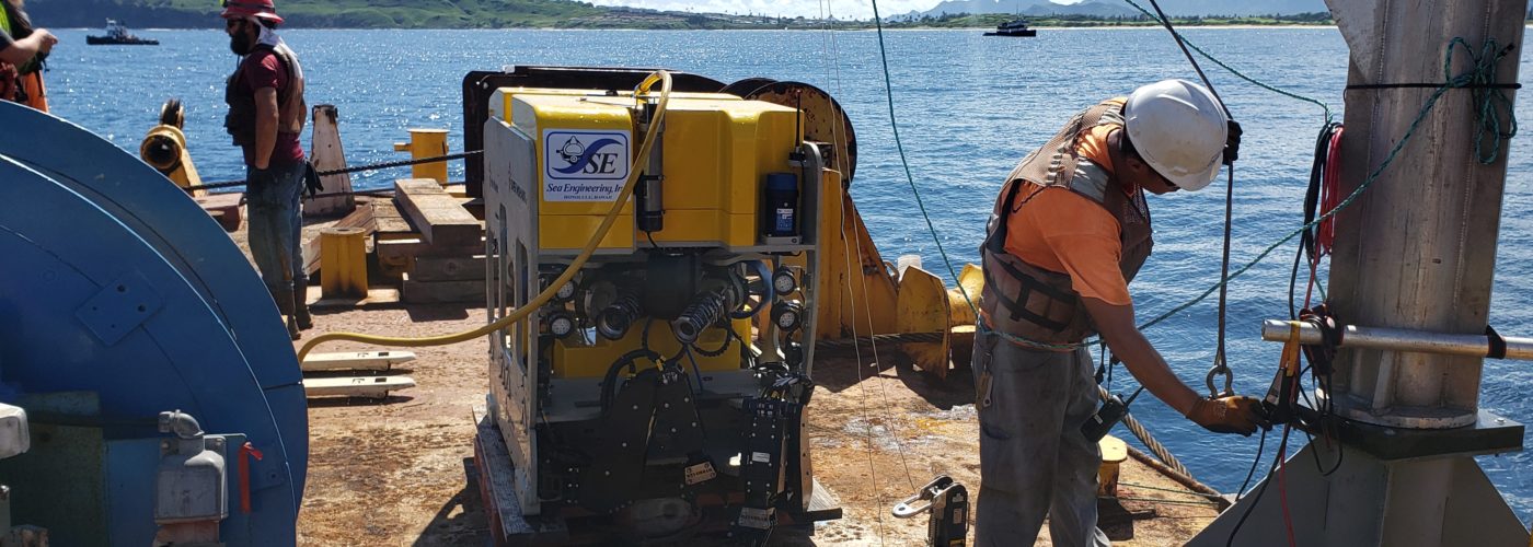
Engineers from Sea Engineering, Inc. conducted a high-resolution multibeam hydrographic survey of the navigation channels, basins, and berthing areas within Pearl Harbor. The survey was conducted over 10 months working with ship schedules to survey areas obstructed by vessels at berth. The survey vessel for this project was Sea Engineering’s 25 ft Whaler. The survey boat made of rigid-hulled fiberglass and aluminum with two 125 horsepower engines provided dependable steerage and maneuverability. The boat was equipped with custom a fixed aluminum beam that has rigid attachment points for a:
- Multibeam transducer
- Inertial navigation unit
- Real time kinematic (RTK) antenna
Color-coded maps of the bathymetry along with one-foot and five-foot resolution data sets were provided to the client.